The Grand Canyon
A business trip to Phoenix, Arizona in September 2023 provided the perfect opportunity for a day trip to the Grand Canyon.
Same procedure as every year?
As is the case every year, my projects at work once again included a large meeting of several working groups in the USA in September. These meetings usually take place on the East Coast, somewhere in a larger radius around Charleston, South Carolina. But there was a surprise in store for 2023: our meetings were merged with another conference and moved to Phoenix, Arizona! There has only ever been one “outlier” like this before: 2015 in Albuquerque – that was the trip that got me into taking photography more serious.
With the new destination came the question: what can you see and photograph there? Phil, my best friend in the USA, advised me to definitely seize the opportunity to visit the Grand Canyon. And indeed, it’s only a few hours’ drive from Phoenix to the southern entrance of the national park! So, the goal was set.
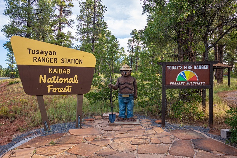
The time frame was determined by the schedule of the conference and my flights. I had free time from Thursday lunchtime to Friday evening – tight, but doable. I booked a hotel room in Tusayan, so that I could drive there on the first day, then start at the Grand Canyon on the second day in the morning, and be back in Phoenix in the evening for the flight back to Germany the next morning. A suitable small rental car was also quickly organized.
Off to the Grand Canyon
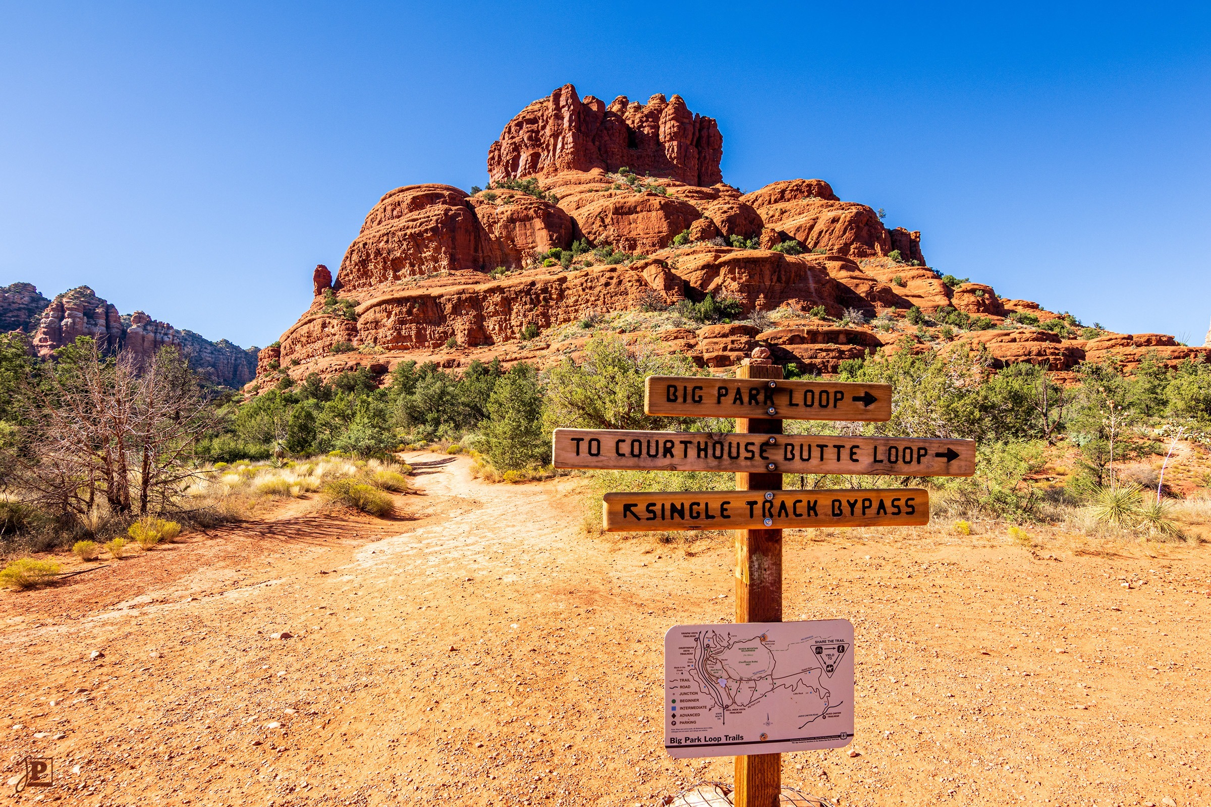
The five days of meetings from Sunday to Thursday passed very quickly; there was simply too much to do for time to be drawn out in any way. As soon as the last session was over, I made my way to the airport to pick up the rental car. From there, I headed directly north on Interstate 17 and State Road 179, and then on to Sedona. The “Red Rocks” there were recommended to me by several conference participants as a “must see” and were therefore the first destination of the trip.
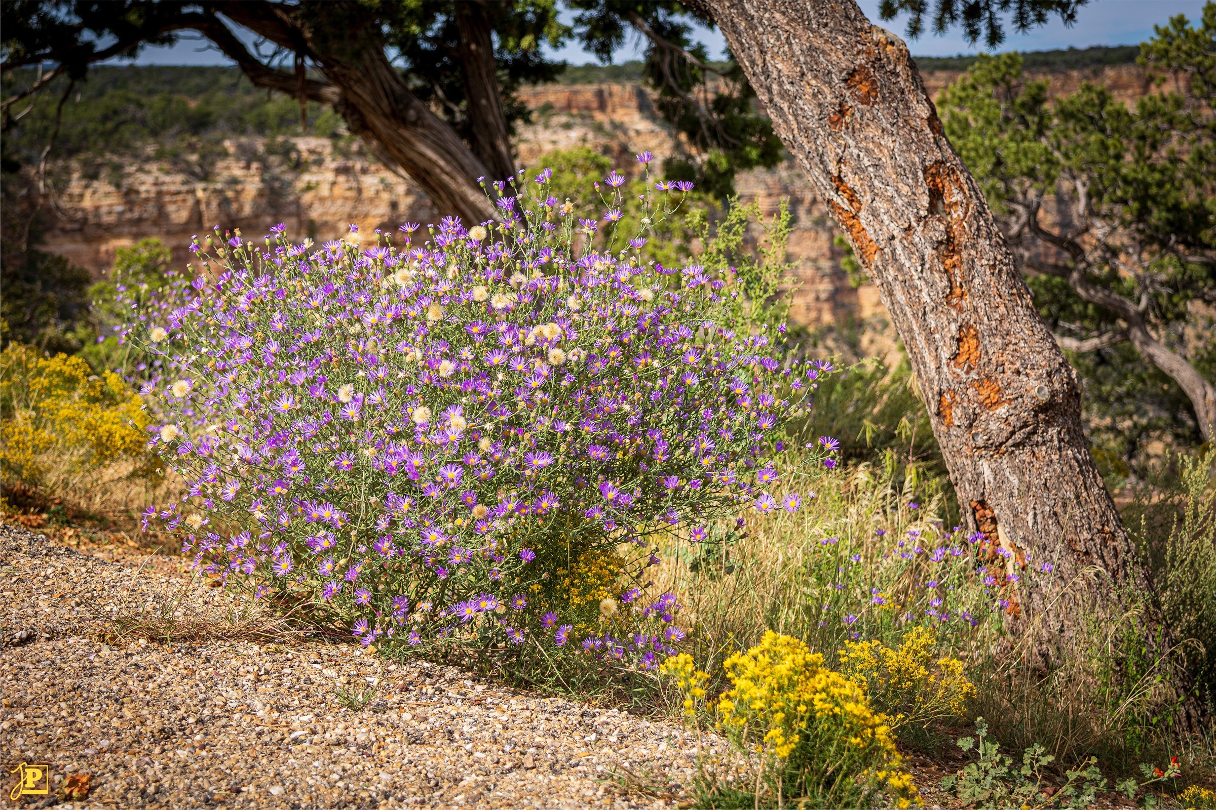
And indeed, when the first red mountains, Bell Rock (see below) and Courthouse Butte, came into view, it was very impressive. I made several photo stops in the area and also walked some of the hiking trails. In addition to the landscape, I was also impressed by the flora, a wild mix of bushes, flowers and cacti. Looking at the time, however, I quickly moved on.
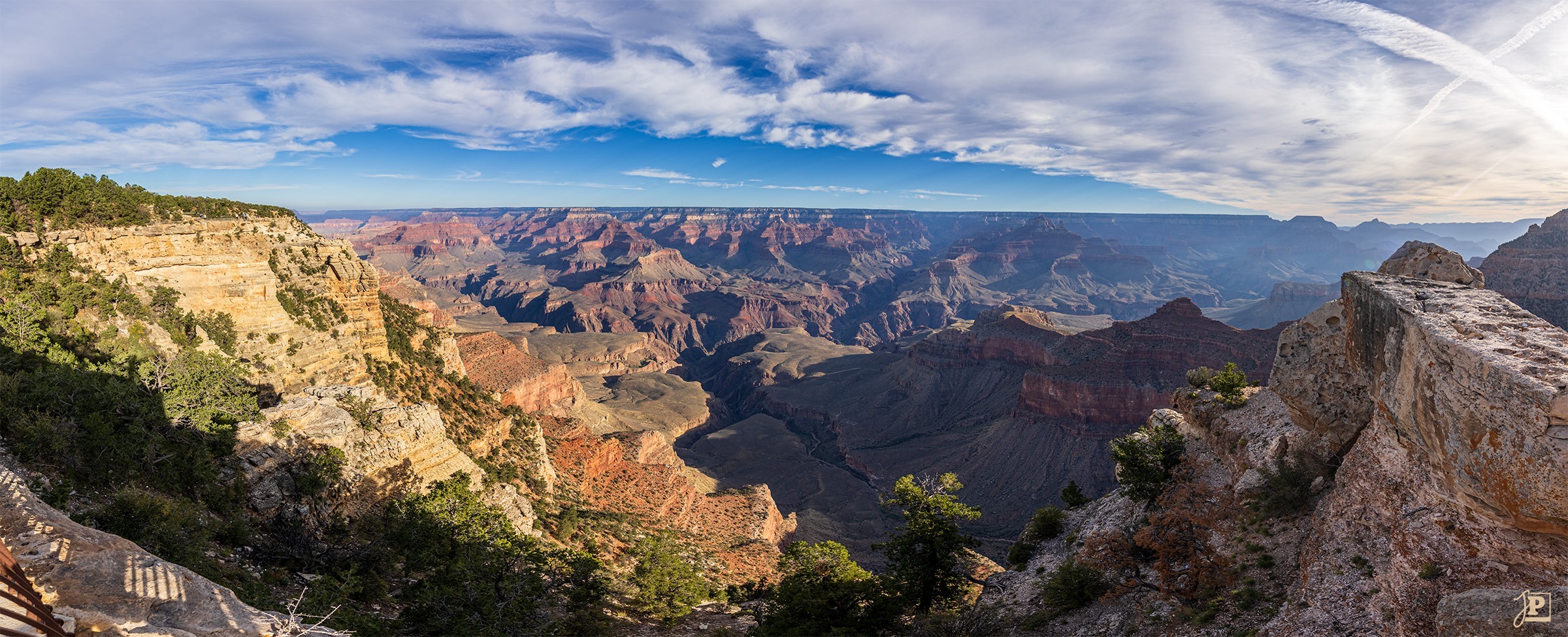
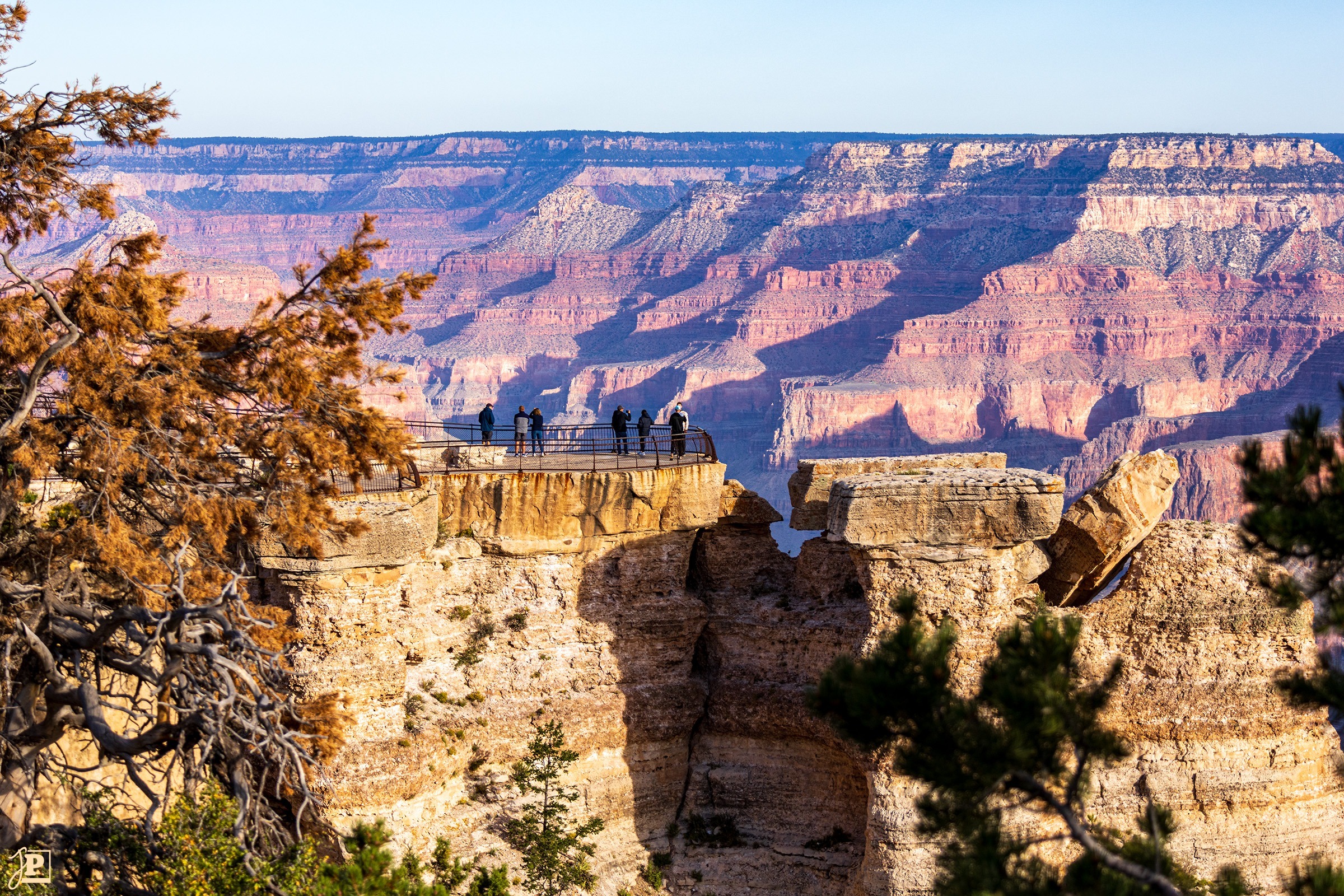
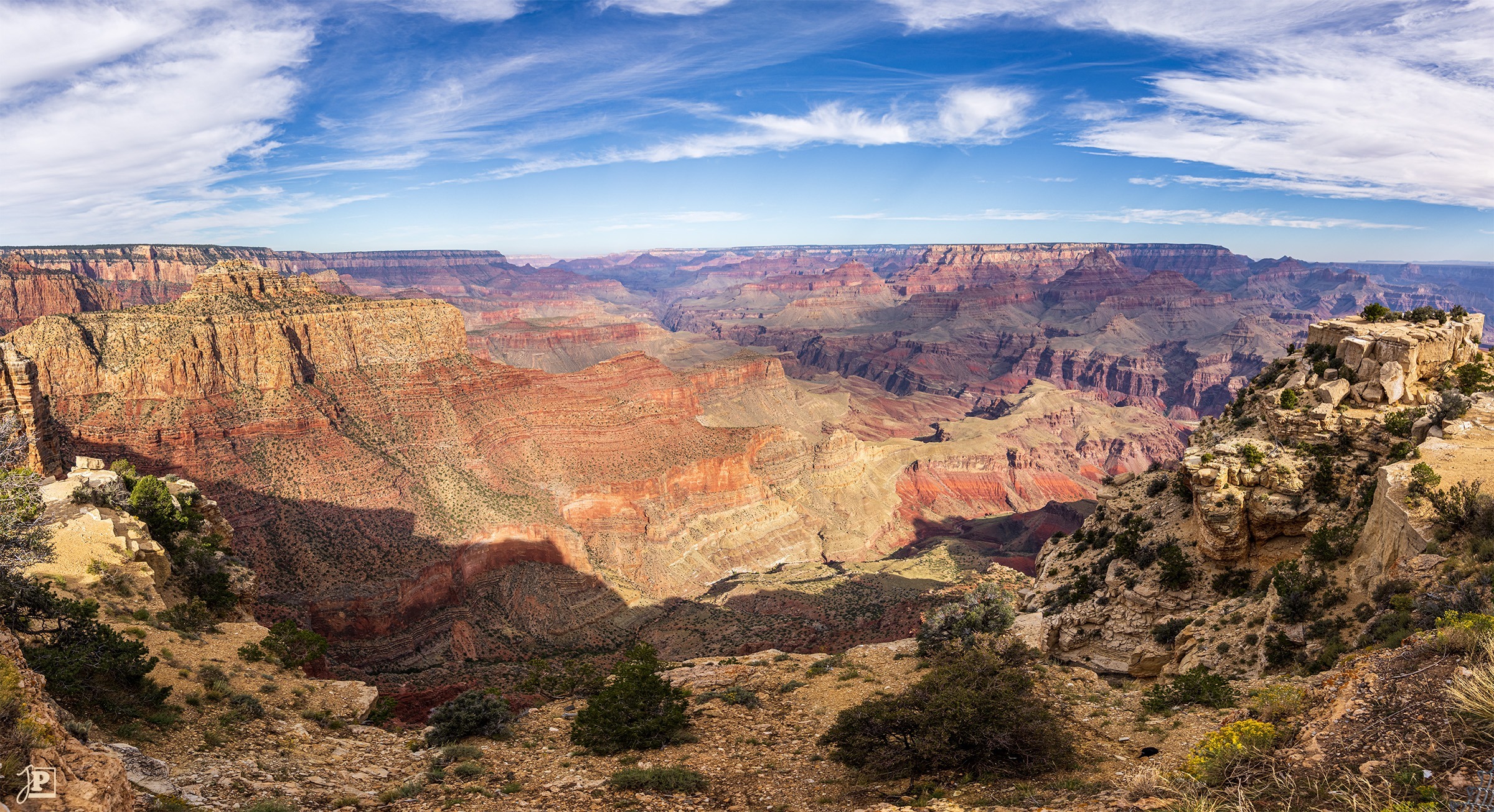
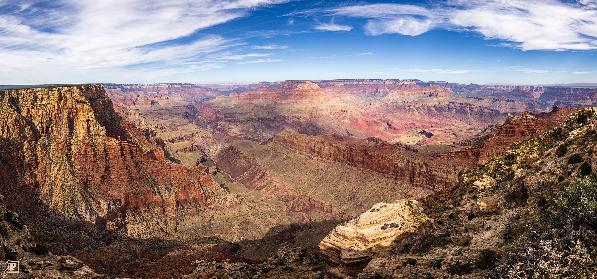
After a short night in Tusayan – including a fantastic night sky – I set off early the next morning for the South Rim of the Grand Canyon. The first stop was at “Mather Point” near the visitor center. The first view into the canyon was simply breathtaking – these incredible, indescribable dimensions! I stood there for quite a while and just took in the landscape.
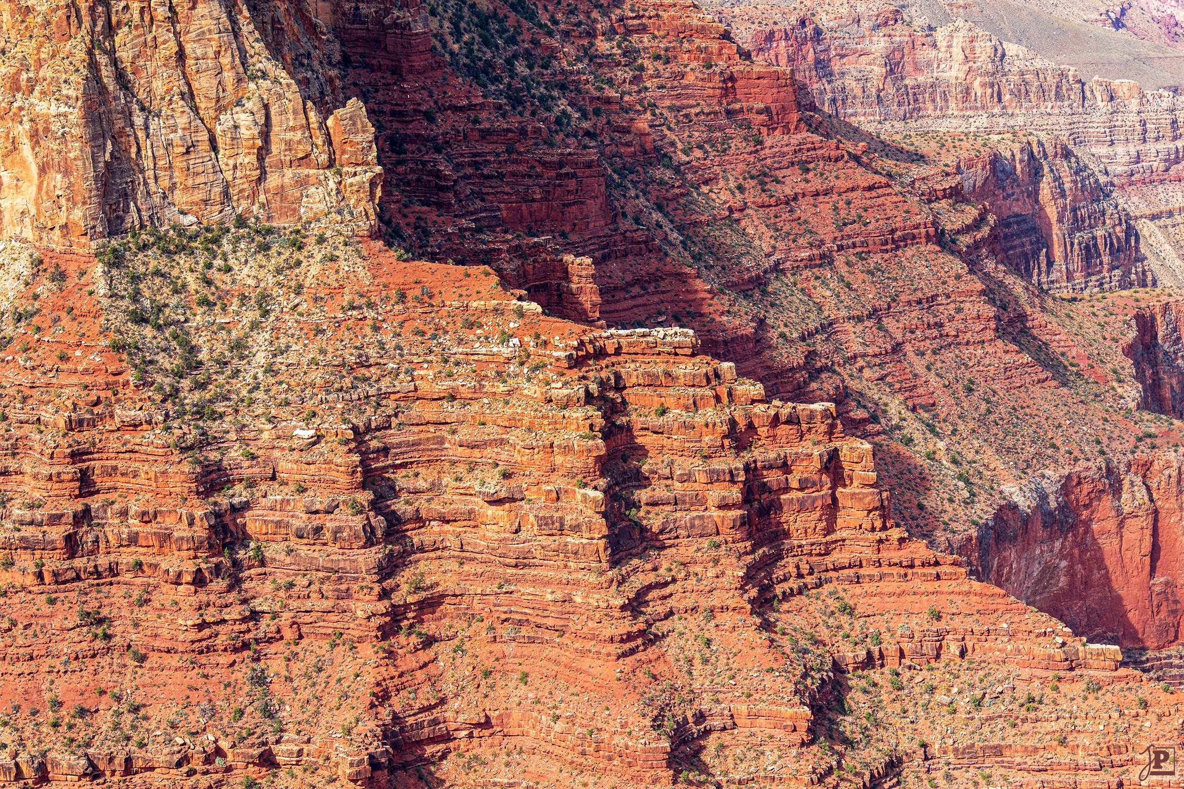
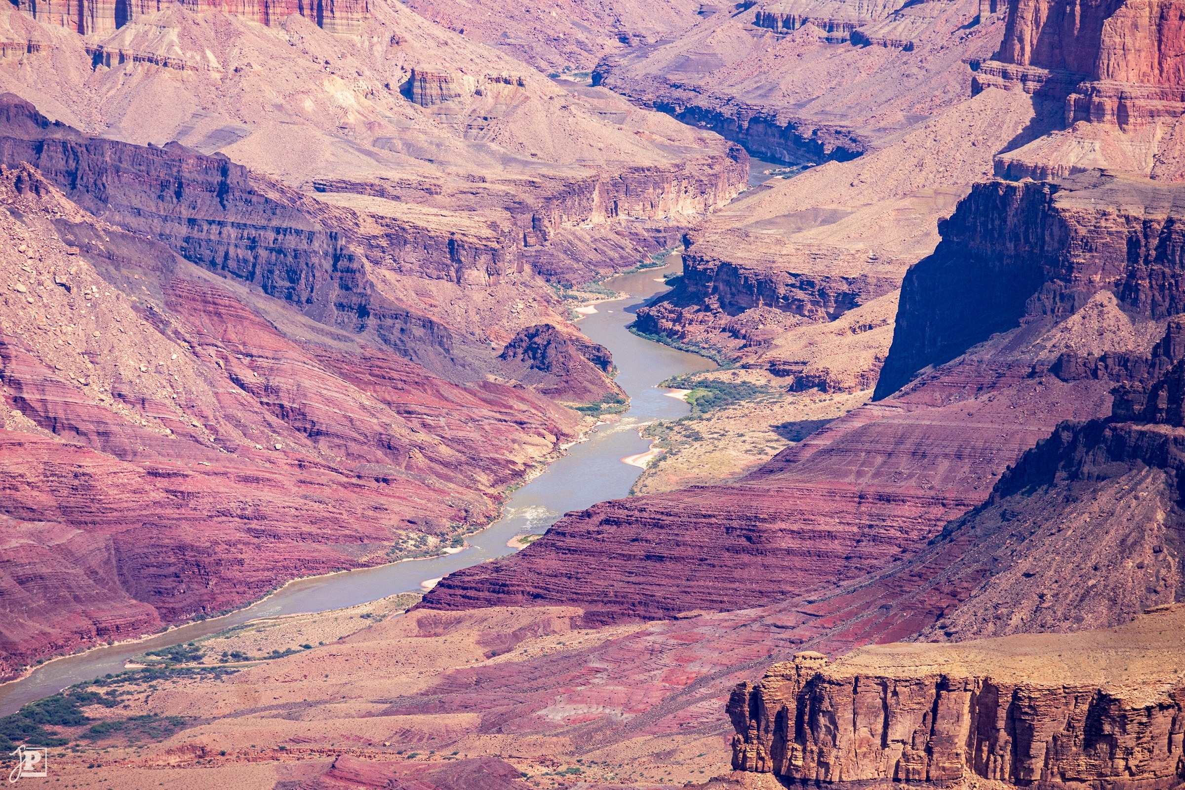
Over the course of the morning, I then worked my way along the road, viewpoint by viewpoint: Pipe Creek Vista, Duck on a Rock, Grandview Point, Moran Point, Lipan Point, Navajo Point, up to the Desert View Watchtower. It is difficult, if not impossible, to capture the proportions in a picture. The photos simply don’t show that it is sometimes 8-12 miles or even more to the opposite edge! In many places, it was simply not enough to take just one photo. So I took whole series of pictures with different viewing directions and exposures, and then blended them together at home to create HDR panoramas. Some of the pictures below are made up of over 30 individual photos!
Bonus Leg
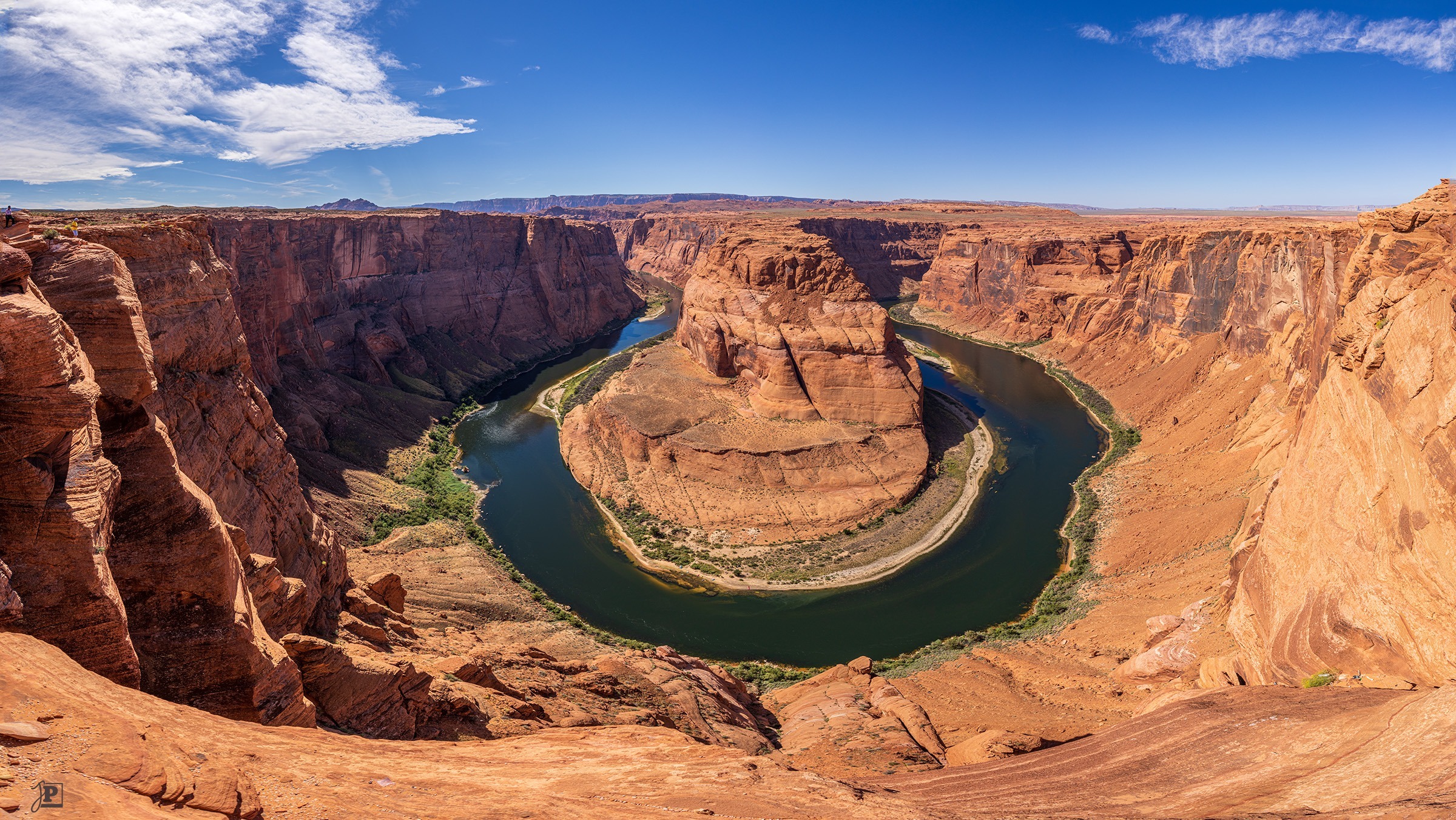
One of the most famous photo subjects in connection with the Grand Canyon, although strictly speaking it is not part of it, is the Colorado River loop near Page, Arizona, known as “Horseshoe Bend”. This is another two hours’ drive north of Desert View Point. I had looked at the various routes and travel times in the hotel the night before and calculated that if I could make it to the exit of the Grand Canyon by noon, I could make the detour to Page and still be back in Phoenix in time to visit a good friend.
The big unknown was the weather. After a cloudless Thursday, the forecast predicted cloudy skies and later even rain for the day at the Grand Canyon. So I made my trip dependent on this – if the weather was too bad, I would skip the detour.
But I was lucky: after it was relatively cloudy in the morning, the sky cleared up more and more as the day progressed, and by lunchtime, there was not a cloud to be seen. Everything went according to plan in terms of time as well. So I headed east to Cameron, and then north via Highway 89 to Page.
From the (paid) parking lot, it was a good 20-minute walk to Horseshoe Bend – but the view was well worth it! However, not everything went smoothly: the adapter for my ultra-wide-angle lens broke, there of all places. So I had to make do by taking lots of individual pictures with the standard zoom and then stitching them together at home to create a panorama.
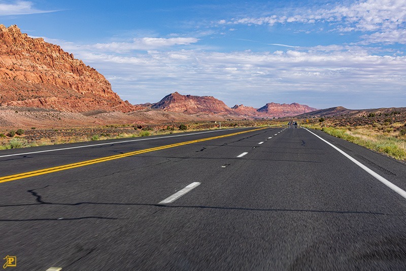
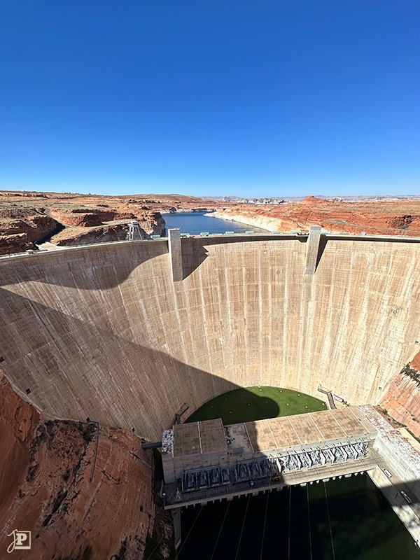
In the end, I even had time to drive a little further to Page and take a look at the Glen Canyon Dam, which closes off Lake Powell. This dam is very impressive in size. Finally, took the direct route back to Phoenix, through unique landscapes that seemed to change completely behind every hilltop. The weather only changed shortly before I reached my destination, giving me some dramatic light effects before I was back in Phoenix just a little later than planned.
The Results
The result is a whole series of photos, especially panoramic shots, which can’t even begin to convey the dimensions of the landscape. For those who have already been there, the photos will hopefully provide a nice memory. The shot of Bell Rock and the flower photo have made it into my 2024 calendar.


You May Also Like
Visit to the Reptile House
Blacksmithing: The Black Art